Explore the map
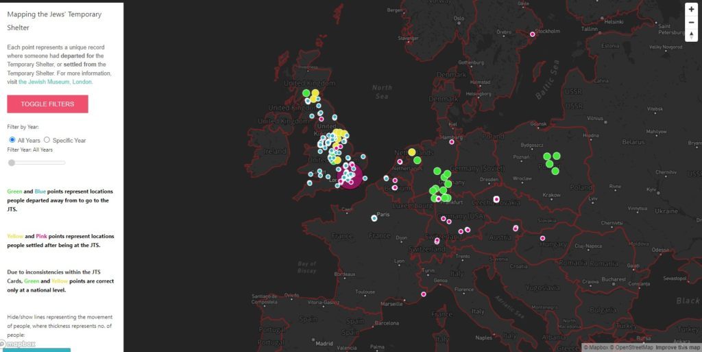
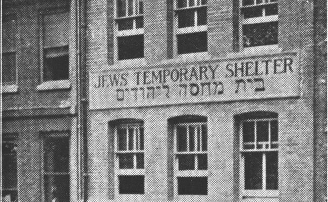
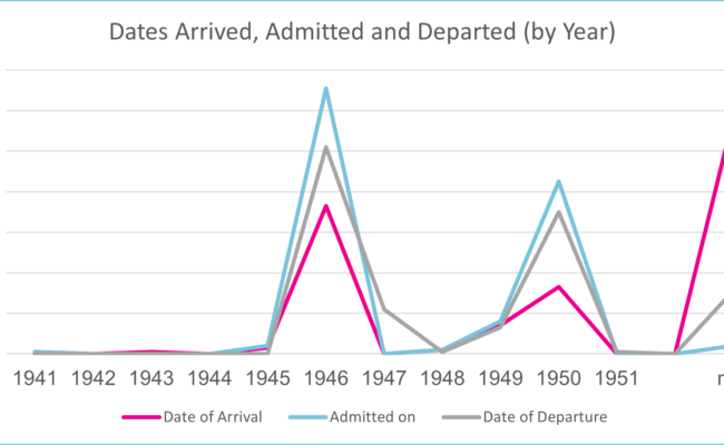
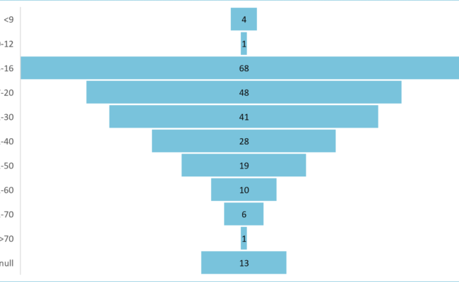
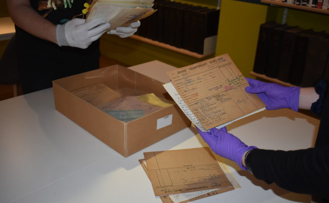
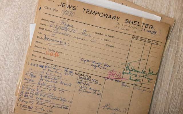
At the start of 2022, Freelancer Lewis Smith worked with the Jewish Museum London to help visualise the Jews’ Temporary Shelter (JTS) collection of records cards. Below is an interactive map showing the arrivals and departures from the JTS throughout the 1940s
To explore the map click the ‘Open Map’ button below – please note the map works best on a desktop.
Top tips for using the map
- Click the ‘toggle filters’ box to change features on the map. You can see information from specific years and show/hide lines representing the movement of people
- Green and Blue points represent locations people departed away from to go to the JTS. – the blue dots show specific cities that were recorded. The Green dots represent data where only the country was recorded – these are plotted around the centre of the country.
- Similarly Yellow and Pink points represent locations people settled after being at the JTS, with the the pink dots showing specific cities that were recorded and the Yellow dots representing data where only the country was recorded – these too are plotted around the centre of the country.
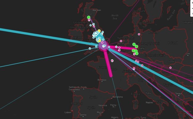
- Clicking the ‘arrived_from_lines’ box brings up lines indicating the cities/countries people left when heading to the JTS. The thicker the line, the more people arrived from this location
- Clicking the ‘departed_to_lines’ box brings up lines indicating the cities/countries people headed to having resided at the JTS. The thicker the line, the more people went to this location
- Zooming in and then clicking on any of the points – Green, Yellow, Blue or Pink – brings up further information taken from the original JTS record card. You can close these fact boxes by clicking the cross in the top right corner of the box
- Some names cannot be revealed due to GDPR reasons
- The large pink spot in London represents the location of the JTS
- The large pink spot west of Gabon in the Gulf of Guinea represents an arbitrary location where the records did not specify a arrived from / departed to location
The JTS Cards Project, Mapping Migration, is supported by The Audience Agency’s Digitally Democratising Archives project thanks to funding from DCMS and the National Lottery, as part of The National Lottery Heritage Fund’s, Digital Skills for Heritage initiative.